


Deering Voting District, Pemiscot County, Missouri
About
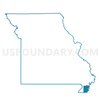
Outline

Summary
| Unique Area Identifier | 609321 |
| Name | Deering Voting District |
| County | Pemiscot County |
| State | Missouri |
| Area (square miles) | 30.71 |
| Land Area (square miles) | 30.61 |
| Water Area (square miles) | 0.09 |
| % of Land Area | 99.69 |
| % of Water Area | 0.31 |
| Latitude of the Internal Point | 36.20127480 |
| Longtitude of the Internal Point | -89.90336810 |
Maps


Graphs
Select a template below for downloading or customizing gragh for Deering Voting District, Pemiscot County, Missouri


Neighbors
Neighoring Voting District (by Name) Neighboring Voting District on the Map
- Bragg City Voting District, Pemiscot County, MO
- Braggadocio Voting District, Pemiscot County, MO
- Hayti 2 Voting District, Pemiscot County, MO
- Independence Rural Voting District, Dunklin County, MO
- Pascola Voting District, Pemiscot County, MO
- Virginia Voting District, Pemiscot County, MO
Top 10 Neighboring County Subdivision (by Population) Neighboring County Subdivision on the Map
- Independence township, Dunklin County, MO (12,991)
- Hayti township, Pemiscot County, MO (3,838)
- Braggadocio township, Pemiscot County, MO (641)
- Pascola township, Pemiscot County, MO (539)
- Virginia township, Pemiscot County, MO (512)
Top 10 Neighboring Unified School District (by Population) Neighboring Unified School District on the Map
- Kennett 39 School District, MO (10,898)
- Hayti R-II School District, MO (3,876)
- South Pemiscot Schools, MO (3,594)
- North Pemiscot County R-I School District, MO (1,784)
- Delta C-7 School District, MO (906)
Top 10 Neighboring State Legislative District Lower Chamber (by Population) Neighboring State Legislative District Lower Chamber on the Map
Top 10 Neighboring State Legislative District Upper Chamber (by Population) Neighboring State Legislative District Upper Chamber on the Map
Top 10 Neighboring 111th Congressional District (by Population) Neighboring 111th Congressional District on the Map
Top 10 Neighboring Census Tract (by Population) Neighboring Census Tract on the Map
- Census Tract 3604, Dunklin County, MO (4,396)
- Census Tract 4702, Pemiscot County, MO (3,613)
- Census Tract 4705, Pemiscot County, MO (3,095)
- Census Tract 4701, Pemiscot County, MO (2,189)
- Census Tract 3609, Dunklin County, MO (1,959)
Top 10 Neighboring 5-Digit ZIP Code Tabulation Area (by Population) Neighboring 5-Digit ZIP Code Tabulation Area on the Map
- 63857, MO (12,956)
- 63851, MO (4,225)
- 63877, MO (3,931)
- 63827, MO (829)
- 63849, MO (186)
- 63826, MO (84)